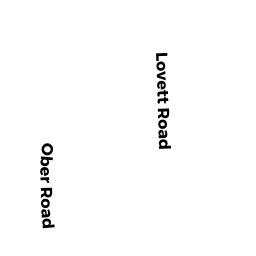
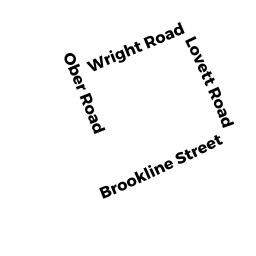
72-80 OBER RD
Owner Information
72-80 OBER RD MASTER DEED
None
None, None None


Property Details
72-80 OBER RD is classified as a Other, Open Space (Condominium).
The primary structure on this property was built in 1890. There are 7,239ft2 of built area within this property. There is 5,342ft2 of residential/living space within this property.
72-80 OBER RD is valued at $0. The land is valued at $0 and the structures are valued at $0.
This property is in Zone MR3. Confirm with local Zoning Board authorities to ensure there are no overlays or other easements on this property.
The most recent deed for 72-80 OBER RD is recorded at the local registrar in Book 14344, Page 391.
Assessment data from fiscal year 2022.
Flood Data
According to the FEMA National Flood Hazard Layer, this property does not appear to be in a flood zone. It may also be in an area not yet reviewed. Nonetheless, confirm this information prior to taking any action.
To view the flood hazards around this property, create a FEMA "Firmette" Map of the area around 72-80 OBER RD.
Broadband Internet Providers
| Provider | Type | Bandwidth (mbps) | |
|---|---|---|---|
| Verizon New England Inc. | DSL | 5 | 0 |
| Verizon New England Inc. | Fiber | 940 | 880 |
| Viasat Inc | Satellite | 100 | 3 |
| Comcast | Cable | 1000 | 35 |
| RCN | Cable | 500 | 20 |
| RCN | Cable | 1000 | 20 |
| GCI Communication Corp. | Satellite | 0 | 0 |
| VSAT Systems, LLC. | Satellite | 2 | 1 |
| HughesNet | Satellite | 25 | 3 |
Broadband service provider data from December 2020.
Adjacent Properties
- 42 SKY VIEW CIR
Single Family Residential owned by SIMEONE FRANK J & HARLEY - 77 OBER RD
Single Family Residential owned by PEDRAZA LUIS A - 39 SKY VIEW CIR
Single Family Residential owned by KELER RON & TALI - 313 COUNTRY CLUB RD
Single Family Residential owned by HOLBIK THOMAS - 321 COUNTRY CLUB RD
Single Family Residential owned by GOLDSTEIN BARRY & LEAT L/E - 283 COUNTRY CLUB RD
Single Family Residential owned by LARACH GUSTAVO N & ROSA D - 291 COUNTRY CLUB RD
Single Family Residential owned by ZONG HONG - COUNTRY CLUB RD
CITY OUTBUILDINGS owned by CITY OF NEWTON - 30 OBER RD A
Residential Condominium owned by ZHANG XUESONG - 32 OBER RD B
Residential Condominium owned by CIRILLO ROXANNE - 34 OBER RD C
Residential Condominium owned by MASLER WENDY - 36 OBER RD D
Residential Condominium owned by HOWELL MARIAN B - 40 OBER RD E
Residential Condominium owned by HECHTMAN ABIGAIL R TR - 42 OBER RD F
Residential Condominium owned by YAZDANI ALIREZA - 44 OBER RD G
Residential Condominium owned by SHRIBER RICHARD J - 48 OBER RD H
Residential Condominium owned by WANG WENXIAN - 68 OBER RD J
Residential Condominium owned by BRUKER IZI - 66 OBER RD K
Residential Condominium owned by KOLLAARD DINGENA & HANS P TRS - 64 OBER RD L
Residential Condominium owned by ATALLA IMAD - 62 OBER RD M
Residential Condominium owned by KATS MARK - 60 OBER RD N
Residential Condominium owned by TARASENKO ALEXANDER - 46 OBER RD O
Residential Condominium owned by ABRAHAMIAN CHRISTINE J TR - 26 OBER RD P
Residential Condominium owned by FAIN BARBARA J - 28 OBER RD Q
Residential Condominium owned by LOZOVSKY IRINA - 38 OBER RD R
Residential Condominium owned by TELLES-PALLADINO DEBORAH S - 70 OBER RD #S
Residential Condominium owned by MOJAHED BRANDON - 54 OBER RD T
Residential Condominium owned by BURMISTROVICH IRENA - 52 OBER RD U
Residential Condominium owned by WHISTLER PETER - 58 OBER RD V
Residential Condominium owned by RIORDAN JAMES F - 56 OBER RD W
Residential Condominium owned by GOMEZ ROBERT M - 26-70 OBER RD
Other, Open Space owned by 26-70 OBER RD MASTER DEED - 301 COUNTRY CLUB RD
Single Family Residential owned by FOURNIER SUZANNE